FROM THE ARCHIVES
THE TOFINO DECEPTION
ANCIENT SITES
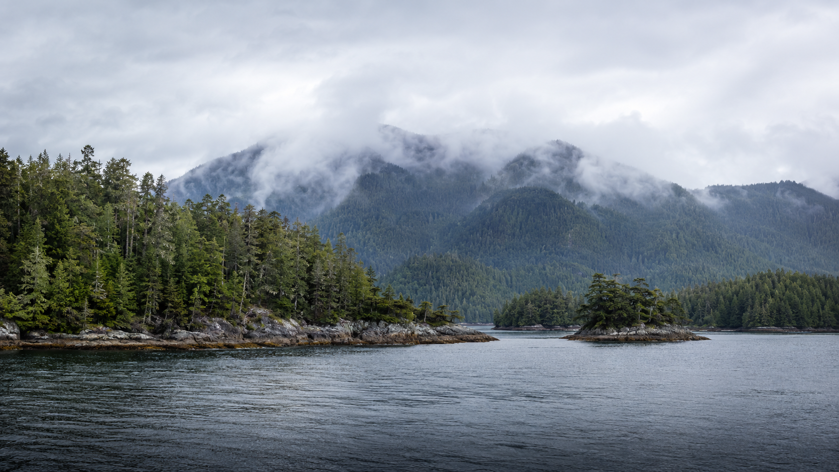

CLAYOQUOT SOUND AND THE TLA-O-QUI-AHT CULTURAL LANDSCAPE: An Indigenous Landscape of Land and Sea
Set along the rugged west coast of Vancouver Island, Clayoquot Sound is a vast coastal wilderness of ancient temperate rainforest, sheltered waterways, tidal inlets and forested islands. Centred around the community of Tofino, the region lies within the traditional territories of the Nuu-chah-nulth First Nations, whose connection to the land and sea extends back thousands of years. Its rich marine ecosystem, dramatic mountain backdrop and powerful Pacific weather make Clayoquot Sound one of British Columbia’s most remarkable natural landscapes.
-
Clayoquot Sound has been home to Nuu-chah-nulth peoples for thousands of years. The Hesquiaht, Ahousaht and Tla-o-qui-aht Nations developed communities throughout the region, drawing food, materials and trade from its forests, rivers and coastal waters. Their hereditary chiefs governed defined territories, while cultural teachings emphasized the close relationship between people and the natural world. The name “Clayoquot” developed from an anglicized form of Tla-o-qui-aht, the Nation whose traditional territory includes the area around present-day Tofino.
European traders began visiting the west coast of Vancouver Island during the late eighteenth century. The maritime fur trade brought profound changes to the region, followed by colonial settlement, commercial fishing, mining and forestry. Tofino developed as a coastal settlement during the early twentieth century, while logging became increasingly important to the local economy. Large areas of ancient temperate rainforest were opened to industrial harvesting, creating growing conflict over how the land should be managed.
That conflict reached international attention during the struggle to protect Clayoquot Sound’s old-growth forests. In 1984, the Tla-o-qui-aht First Nation and environmental campaigners opposed plans to clear-cut Meares Island, an important cultural landscape and the source of Tofino’s drinking water. The Nation declared the island a Tribal Park, and a court injunction halted logging while Indigenous land claims remained unresolved. Protests expanded throughout the following decade, culminating in the 1993 Clayoquot protests, often called the “War in the Woods.” Thousands participated in demonstrations and road blockades, and more than 800 people were arrested in what was then the largest campaign of civil disobedience in Canadian history.
The protests transformed public understanding of old-growth forestry and led to new approaches to conservation, scientific management and Indigenous participation in decisions about the region. In 2000, approximately 350,000 hectares of Clayoquot Sound were designated a UNESCO Biosphere Reserve. The designation recognizes both its extraordinary ecosystems and its living communities. Today, the Sound remains within the traditional territories of the Nuu-chah-nulth Nations, whose leadership continues to shape efforts to protect its forests, waterways, wildlife and cultural heritage.
-
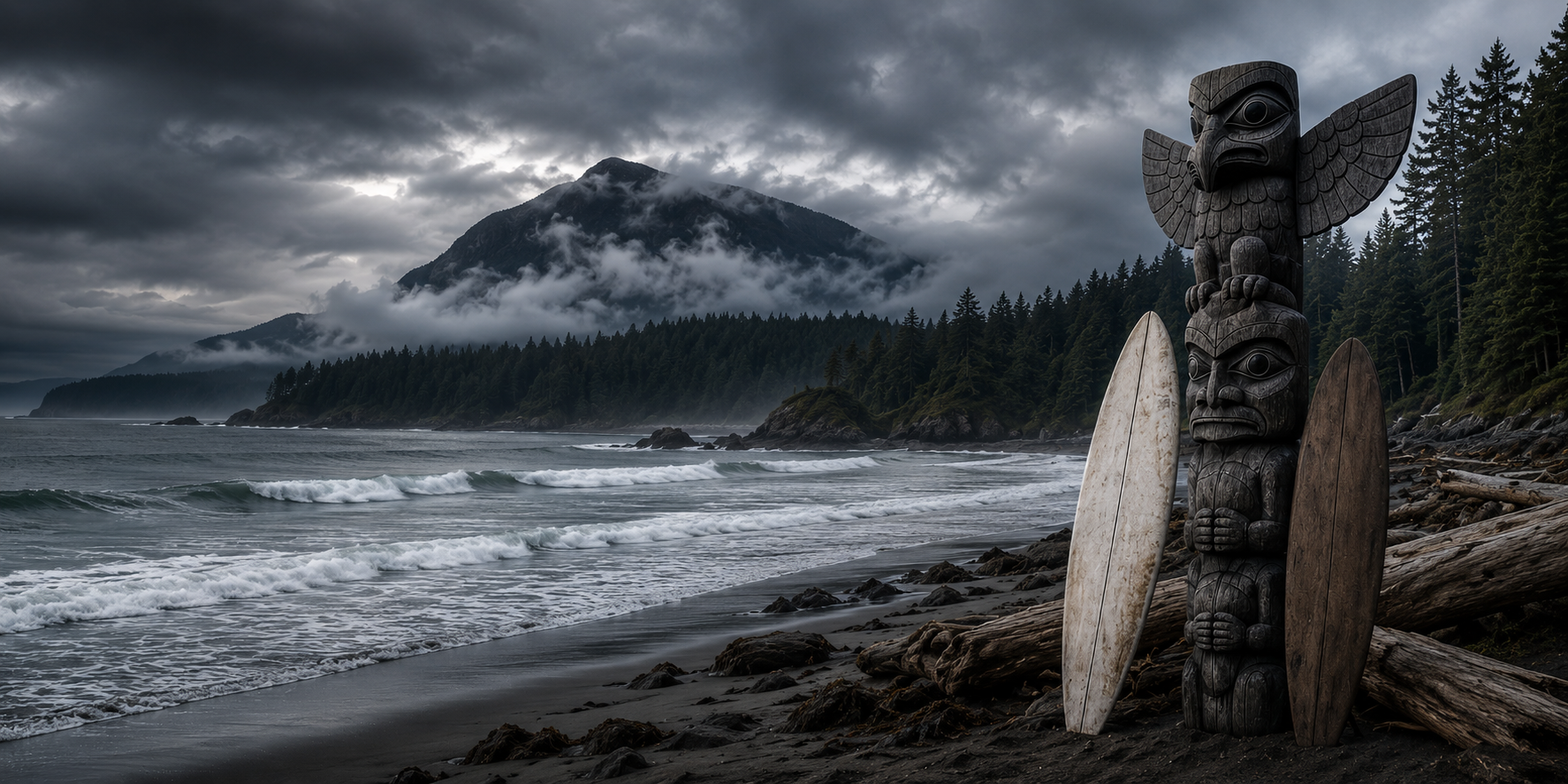
In The Tofino Deception, Clayoquot Sound forms the coastal heart of the novel’s mystery. The story begins in 1770, when the storm-damaged Chinese vessel Blue Orchid reaches the western coast of Vancouver Island and encounters the Tla-o-qui-aht people. The ship eventually disappears during its return voyage, but memories of its arrival survive through the fictional Tla-o-qui-aht story of the “Ship of Winds” and a series of carved wooden objects left behind.
Centuries later, Irene discovers a weathered carving on South Chesterman Beach whose spirals and three-circle markings appear connected to that forgotten voyage. With guidance from Tla-o-qui-aht elder Elijah Thomas, the group begins to understand that the markings may preserve knowledge of currents, journeys and safe passages through the region. At the same time, George, Áine and Jazz uncover secret survey work around Kennedy Lake and the surrounding coast, drawing them into a corporate operation threatening the waters and communities of Vancouver Island. Clayoquot Sound therefore becomes more than the novel’s dramatic setting: it is the place where Indigenous memory, maritime history and the modern struggle over natural resources converge.
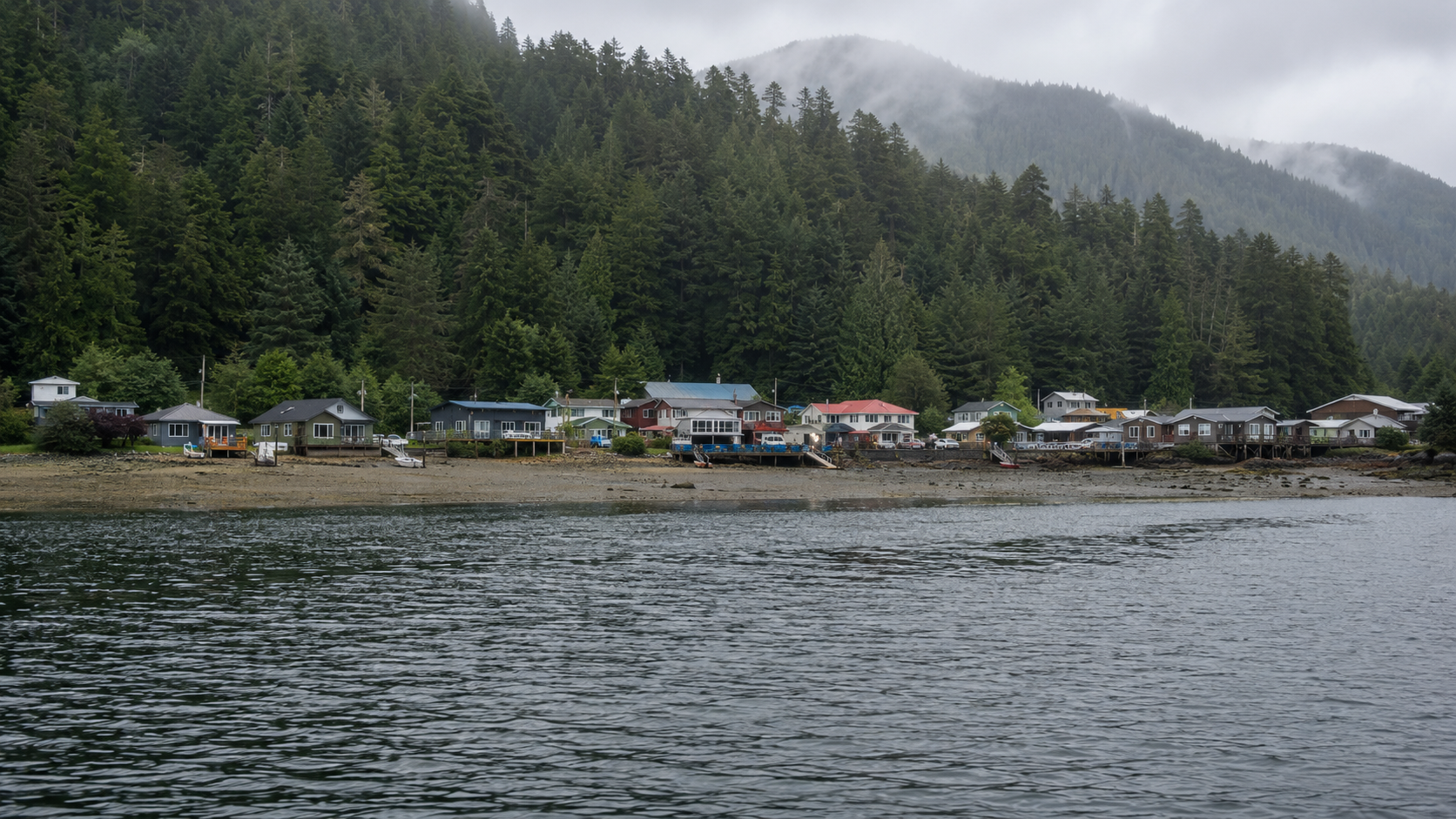
OPITSAHT, MEARES ISLAND: The Ancient Village Across the Water
Situated on the southwestern shore of Meares Island, directly across the water from Tofino, Opitsaht is a historic and living community of the Tla-o-qui-aht First Nation. Surrounded by the ancient rainforests and sheltered waters of Clayoquot Sound, the village reflects a cultural connection to the land and sea extending back countless generations. Accessible primarily by boat, Opitsaht remains an important centre of Tla-o-qui-aht community life and a powerful reminder that the history of this region began long before European arrival.
-
Opitsaht is one of the oldest continuously inhabited village sites on the west coast of Vancouver Island. Located on Meares Island, it lies within the ḥaḥuułi, or traditional territory, of the Tla-o-qui-aht First Nation. For countless generations, the community’s people drew food and materials from the surrounding ocean, rivers and rainforest. They developed a sophisticated society governed by hereditary chiefs, known as Ha’wiih, whose responsibilities included caring for the territory and protecting its resources for future generations.
By the late eighteenth century, Opitsaht was a large and prosperous village led by the powerful chief Wickaninnish. European visitors described an impressive settlement containing approximately 200 large wooden houses, decorated with carvings that recorded family histories and cultural traditions. The village became an important centre of trade during the maritime fur-trade era, when European and American vessels arrived seeking sea-otter pelts.
In 1792, Opitsaht suffered a devastating attack. Following a dispute, American trader Captain Robert Gray ordered his crew to bombard and burn the village. Approximately 200 houses and their associated carved poles were destroyed while residents were away. Although the community was rebuilt, the attack marked the beginning of a long period of disruption caused by colonial expansion, introduced diseases, the reserve system, restrictions on Indigenous ceremonies and the forced removal of children to residential schools.
Meares Island again became the centre of an important struggle in 1984, when the Tla-o-qui-aht opposed plans to clear-cut its ancient rainforest. The Nation declared Meares Island a Tribal Park, asserting its responsibility to protect the land under Tla-o-qui-aht law. A court injunction prevented logging while Indigenous title remained unresolved, making the campaign an important early victory in the wider effort to protect Clayoquot Sound.
Today, Opitsaht remains a living Tla-o-qui-aht community rather than simply a historic site. Its homes, cultural facilities and newly raised carved poles reflect both the survival and renewal of Tla-o-qui-aht culture. Situated directly across the water from Tofino, the village stands as a powerful reminder of a history that reaches far beyond European contact and continues into the present.
-
In The Tofino Deception, Opitsaht becomes an important link between Irene’s discovery on South Chesterman Beach and the Tla-o-qui-aht story of the “Ship of Winds.” Elder Elijah Thomas tells her that, generations earlier, carved planks from the mysterious vessel washed ashore after a storm. According to the novel, one of those planks was preserved in the longhouse at Opitsaht, bearing the same spiral and three-circle pattern Irene recognizes on the weathered carving she has found.
Elijah also describes whalebone paddles kept at Opitsaht whose spiral designs represent repeating paths through currents, winds and seasons. These objects help Irene understand that the markings may preserve navigational knowledge rather than serving as simple decoration. Although the characters do not visit Opitsaht itself, the village serves as a guardian of cultural memory and provides a vital clue connecting the fictional Chinese voyage of 1770 with the modern mystery unfolding around Clayoquot Sound.
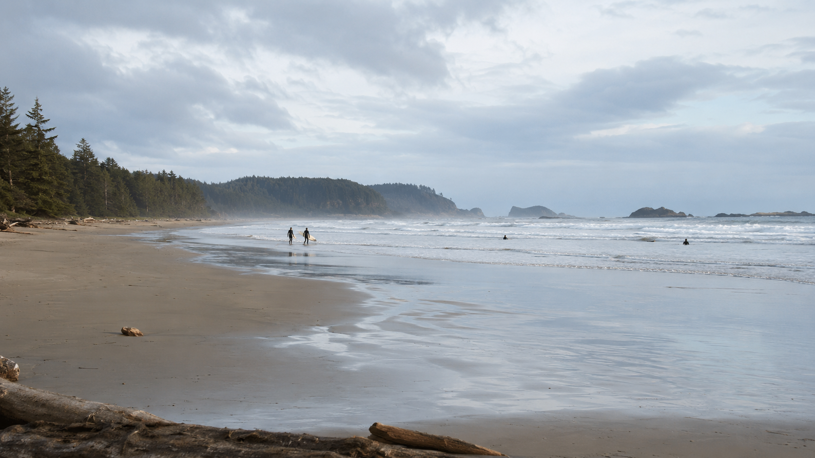
LONG BEACH: An Ancient Coast Facing the Pacific
Stretching along the Pacific coast of Vancouver Island, Long Beach is the largest and most famous beach within Pacific Rim National Park Reserve. Its broad expanse of sand, powerful ocean swells and forested shoreline capture the wild character of the region surrounding Tofino and Ucluelet. Long associated with the traditional territories of the Tla-o-qui-aht and Yuułuʔiłʔatḥ First Nations, the beach is now renowned for its natural beauty, abundant wildlife and year-round surfing.
-
Long before it became a national park destination, Long Beach formed part of the traditional territories of the Tla-o-qui-aht First Nation and Yuułuʔiłʔatḥ. For countless generations, Nuu-chah-nulth communities travelled along this coastline, harvested resources from the ocean and rainforest, and maintained important cultural and spiritual connections with the land. Beaches were not empty wildernesses but parts of established territories governed by hereditary chiefs and sustained through inherited knowledge of the tides, seasons and marine environment.
European maritime traders arrived along Vancouver Island’s west coast during the late eighteenth century. Colonial settlement developed gradually because the coastline remained difficult to reach by land. Fishing, forestry and trading became important industries around Tofino and Ucluelet, but Long Beach itself remained comparatively isolated well into the twentieth century.
During the Second World War, the area acquired strategic importance as Canada strengthened the defences of its Pacific coast. The Royal Canadian Air Force constructed an airfield near Long Beach in 1941, while wooden posts were reportedly driven into parts of the beach to prevent enemy aircraft from using the sand as a landing strip. Military construction helped create a road between Tofino and Ucluelet. Highway 4 reached the region in 1959, finally providing a direct overland connection with the rest of Vancouver Island and opening Long Beach to increasing numbers of visitors.
Pacific Rim National Park was established in 1970, with Long Beach forming its northernmost and most accessible section. The protected area later became Pacific Rim National Park Reserve, acknowledging that Indigenous rights and title within the region remain unresolved. The park was initially created without proper consultation with the First Nations whose territories it occupies, but it is now managed through cooperative arrangements involving Parks Canada and its Nuu-chah-nulth partners.
During the second half of the twentieth century, Long Beach also became one of the birthplaces of Canadian cold-water surfing. Its exposed Pacific swells attracted an expanding community of local and visiting surfers, helping transform nearby Tofino into Canada’s best-known surfing destination. Today, Long Beach remains both a protected natural landscape and a living part of the traditional homelands of the Tla-o-qui-aht and Yuułuʔiłʔatḥ peoples.
-
In The Tofino Deception, Long Beach reflects the surfing culture that draws George, Áine and Jazz to the west coast of Vancouver Island. George and Jazz take to its cold Pacific waves, finding a brief return to familiar routines while the investigation surrounding Irene’s discovery and the mysterious “Ship of Winds” grows increasingly complicated.
The beach also grounds the novel in the real landscape of the Tofino region. Its powerful surf, changing weather and forest-lined shoreline provide a striking contrast to the sheltered waters of Clayoquot Sound. Long Beach represents the adventurous spirit shared by the characters, while reminding them that the ocean shaping the coast is the same force that carried the novel’s secrets across the Pacific centuries earlier.
REAL PLACES. ANCIENT QUESTIONS
THE NEXT STAGE OF THE ADVENTURE