FROM THE ARCHIVES
THE ATLANTIS ENIGMA
ANCIENT SITES
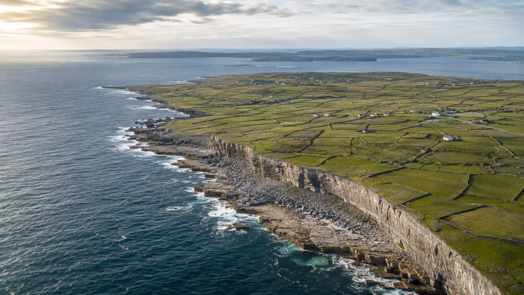

THE ARAN ISLANDS: Fortresses at Ireland’s Western Edge
The Aran Islands rise from the Atlantic off Ireland’s west coast, their rugged limestone landscapes divided by countless dry-stone walls and shaped by centuries of wind, waves and human settlement. Home to prehistoric forts, early Christian ruins and communities where the Irish language remains central to daily life, the three islands of Inis Mór, Inis Meáin and Inis Oírr preserve a powerful connection to Ireland’s past. Their isolation, ancient monuments and enduring folklore make them a natural setting for the mystery at the heart of The Atlantis Enigma.
-
The history of the Aran Islands has been shaped by their position on Ireland’s Atlantic frontier. People have lived on Inis Mór, Inis Meáin and Inis Oírr for thousands of years, creating settlements in a landscape of exposed limestone, limited soil and powerful coastal weather. Although separated from the mainland, the islands were never completely isolated. Their inhabitants maintained connections with communities along Ireland’s western coast through fishing, trade and travel across Galway Bay.
During the early Christian period, the islands became important centres of faith, learning and pilgrimage. Religious communities flourished there, drawn in part by the remoteness of the landscape and its suitability for contemplation. Over the centuries, the islands also experienced the wider political changes affecting western Ireland, including shifting Gaelic rule, English expansion and periods of hardship that encouraged many islanders to leave in search of work elsewhere.
Life on the islands required remarkable ingenuity. Generations of residents created fertile ground by spreading sand and seaweed over the limestone, while extensive dry-stone walls protected the thin soil and divided the small fields. Fishing, farming and seasonal migration supported communities whose traditions were passed down through the Irish language, music, storytelling and folklore. Today, the Aran Islands remain one of Ireland’s strongest Gaeltacht regions, preserving a distinctive cultural identity shaped by resilience, faith and an enduring relationship with the Atlantic.
-
In The Atlantis Enigma, the Aran Islands become the centre of an investigation that draws George, Áine, Jazz and Irene away from the relative comfort of the mainland and into a landscape where history, folklore and the Atlantic are inseparable. The islands’ ancient ruins, exposed limestone and remote coastal setting create an atmosphere in which stories of lost lands and forgotten civilizations no longer seem entirely impossible.
As the group follows the evidence, the islands reveal connections between Ireland’s prehistoric past and the enduring legend of Atlantis. Local traditions, archaeological clues and the constantly changing coastline lead them to question whether the legends were merely stories, or distorted memories of something real. On Aran, the landscape does more than provide the setting for the mystery. It holds the clues that bring the past dangerously close to the present.
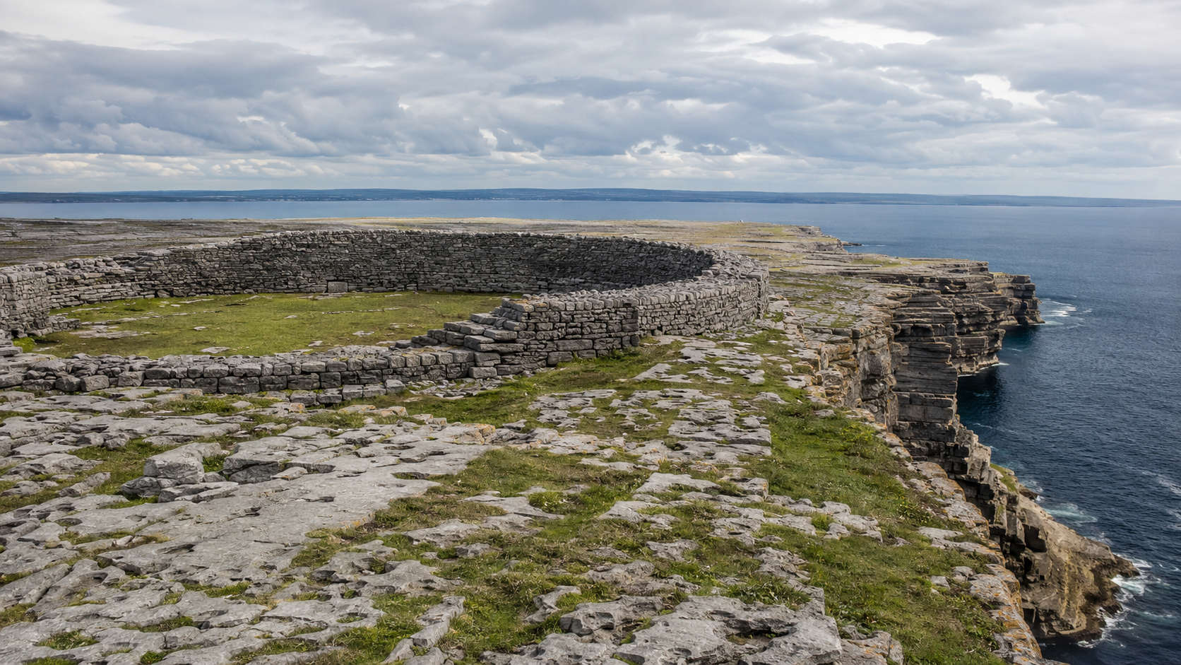
DÚN AONGHASA: A Fortress Above the Atlantic
Dún Aonghasa stands at the edge of a sheer Atlantic cliff on Inis Mór, the largest of the Aran Islands. Enclosed by massive curved walls of carefully laid stone, the prehistoric fort is one of Ireland’s most dramatic archaeological landmarks. Its exposed setting, commanding views and mysterious original purpose offer a powerful glimpse into the lives of the island’s earliest communities and their enduring relationship with the surrounding landscape and sea.
-
Dún Aonghasa was constructed and modified over many centuries rather than built at one time. Archaeological evidence places its earliest major phase around 1100 BC, during the Late Bronze Age. The community that occupied it raised livestock, produced tools and weapons, and worked bronze within the enclosure. Its size and commanding position suggest that it was an important regional centre, possibly associated with a powerful family or community.
The fort gradually developed into a complex series of curved, dry-stone walls enclosing approximately 5.7 hectares. Beyond the inner defences lies a chevaux-de-frise, a dense barrier of upright limestone slabs intended to make approaching the walls extremely difficult. Although these features indicate a defensive purpose, Dún Aonghasa may also have served as a gathering place, ceremonial centre and visible symbol of authority overlooking important Atlantic sea routes.
The site’s importance declined after about 700 BC, although it continued to be used intermittently. During the early medieval period, its walls were substantially strengthened and earlier structures were incorporated into larger fortifications. It was abandoned again not long afterward. Dún Aonghasa became a National Monument in the late nineteenth century and is now preserved by Ireland’s Office of Public Works as the largest of the Aran Islands’ prehistoric stone forts
-
In The Atlantis Enigma, Dún Aonghasa overlooks the waters where Dr. Crawford’s team is investigating a mysterious shipwreck. Although the wreck was believed to belong to the period of the Spanish Armada, several recovered objects appear to be far older. The fort’s commanding position allows George, Áine, Jazz and Irene to see how the archaeological site, the surrounding landscape and the discoveries beneath the Atlantic may be connected.
Local stories describing Dún Aonghasa as protection against both human and otherworldly threats take on new significance as the investigation develops. The fort becomes part of a much larger network involving ancient chambers, ley lines and knowledge preserved by the Order of Eòlas. In the novel, Dún Aonghasa is more than a dramatic setting above the sea. It is one of the places where Ireland’s ancient past begins to reveal its connection to the legend of Atlantis.
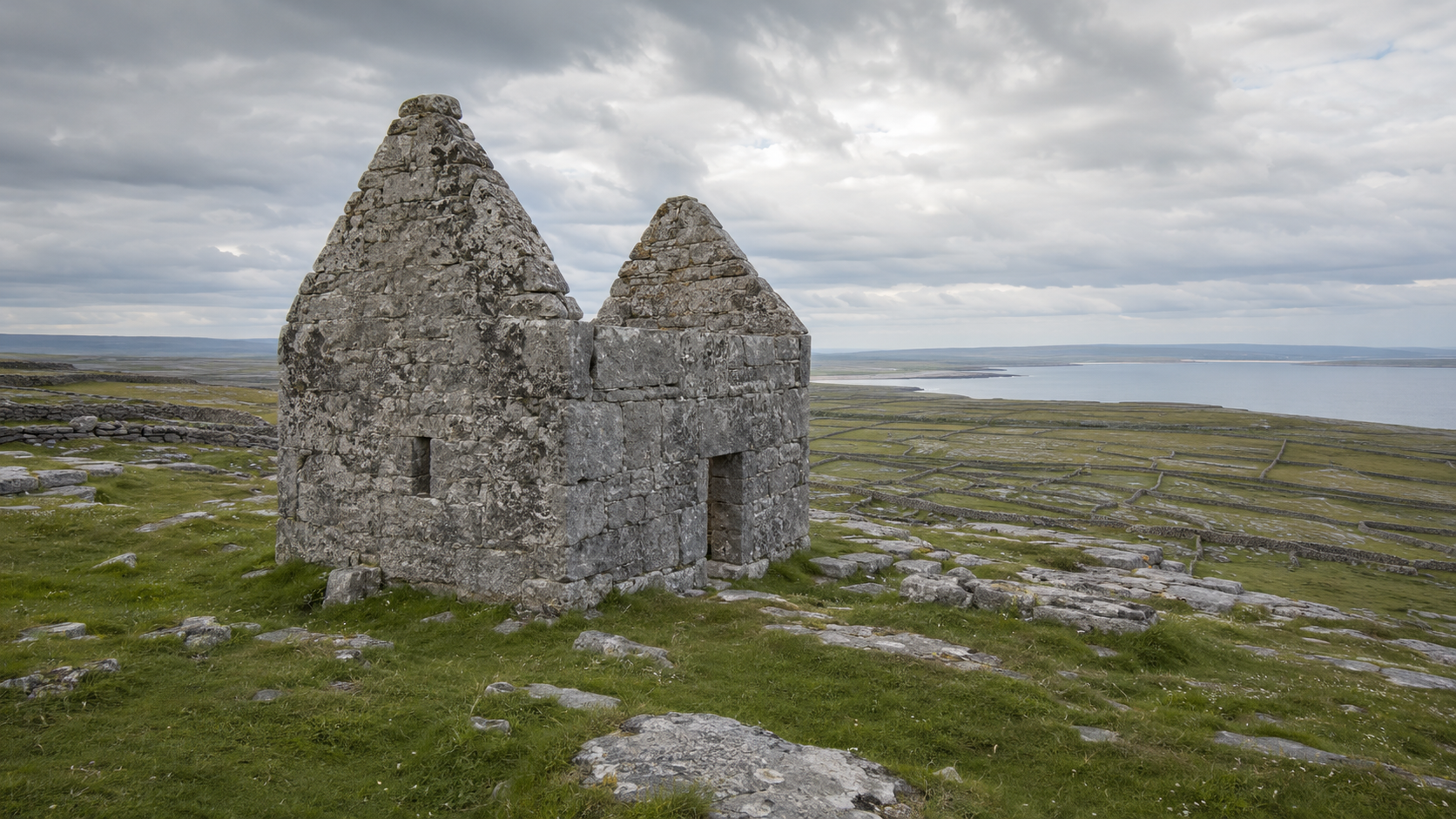
TEAMPALL BHEANÁIN: The Little Church Above the Sea
Teampall Bheanáin is a tiny medieval stone church perched high on a ridge overlooking Cill Éinne Bay on Inis Mór. Dedicated to Saint Beanán, a traditional disciple of Saint Patrick, its steep gables and exposed hilltop setting make it one of the Aran Islands’ most distinctive early Christian landmarks. Though modest in size, the church’s commanding position reflects the importance of faith and pilgrimage in the islands’ history.
-
Teampall Bheanáin was built during the eleventh century as part of the important medieval monastic settlement at Cill Éinne. It is named for Saint Beanán, traditionally believed to have been a disciple of Saint Patrick during the fifth century. The surviving church therefore dates from several centuries after the saint’s lifetime and was probably constructed to honour his association with the island.
With an interior measuring only about six square metres, the building was likely too small to serve as an ordinary church. Archaeologists believe it may instead have functioned as a shrine containing relics associated with Saint Beanán, possibly part of his remains or a sacred object such as a bell or pastoral staff.
The church once formed part of a larger religious landscape that included holy wells, a high cross and a round tower. Its elevated position made it clearly visible to medieval pilgrims arriving by sea, while symbolically allowing the saint’s relics to watch over Cill Éinne Bay and the island beyond. Today, Teampall Bheanáin is protected as an Irish National Monument.
-
In The Atlantis Enigma, George, Áine, Jazz, Irene and Mark travel to the ruins of Teampall Bheanáin as their investigation moves across Inis Mór. Mairead explains that the church is dedicated to Saint Bheanáin, a disciple of Saint Patrick who, according to local tradition, could commune with the ancients and the spirits of the earth and sky. These stories suggest that the modest church may preserve beliefs reaching much further into the past than its Christian origins.
Their investigation leads to the discovery of a hidden chamber beneath the church, drawing Teampall Bheanáin directly into the mystery surrounding Atlantis. The site becomes a meeting point between early Christian tradition, older island folklore and the ancient secrets believed to lie beneath the Atlantic.
THE BURREN: An Ancient Landscape Written in Stone
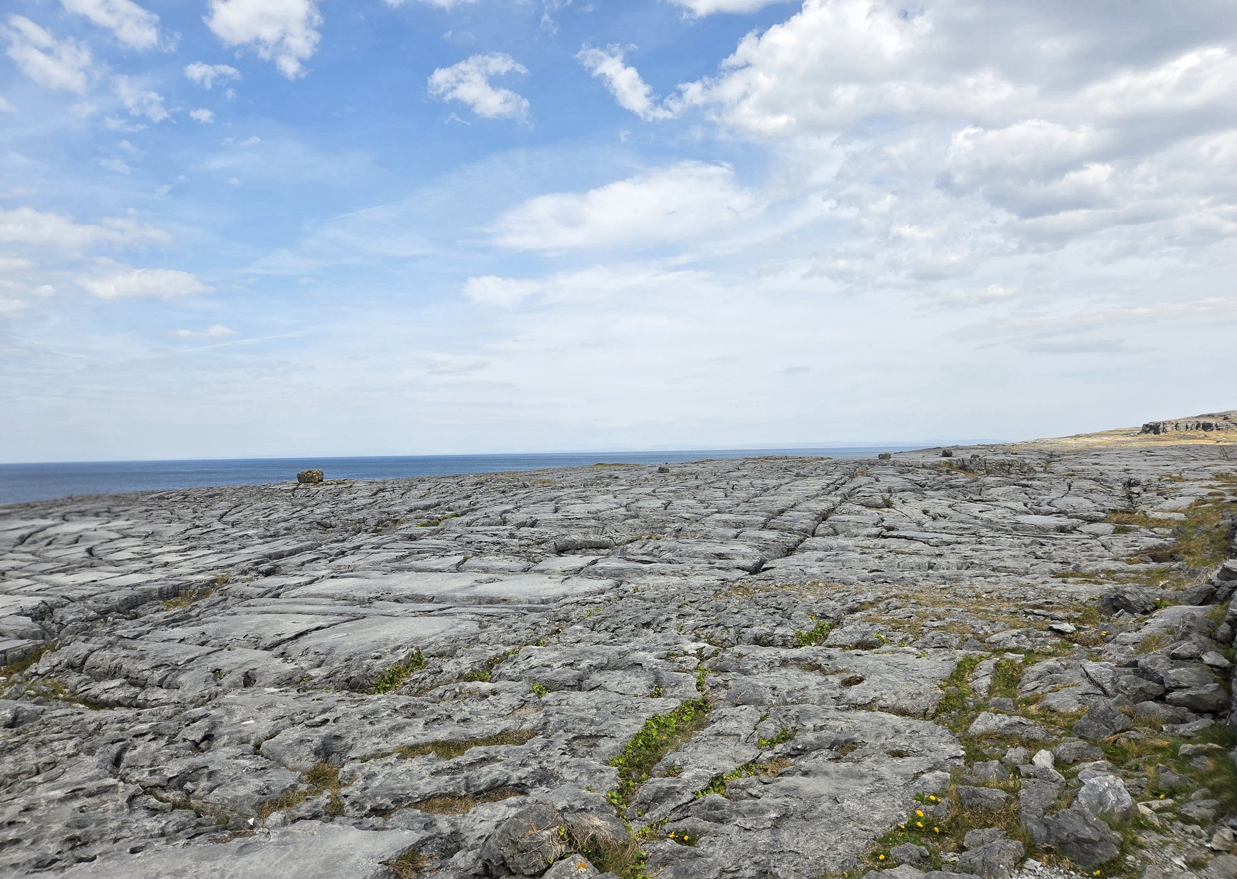
The Burren is a remarkable limestone landscape stretching across northern County Clare, shaped by ancient seas, glacial movement and thousands of years of human settlement. Its exposed pavements, deep fissures and seemingly barren hills conceal rare plant life, underground caves and traces of communities reaching back to prehistoric times. Stark, beautiful and filled with ancient monuments, the Burren provides an atmospheric setting where Ireland’s natural and human histories appear carved directly into the land.
-
The Burren’s history begins with its limestone, formed more than 300 million years ago beneath a warm tropical sea. Much later, successive Ice Age glaciers stripped away soil, widened fractures in the rock and helped create the exposed limestone pavement seen today. Rainwater continued the process by dissolving the stone, forming underground streams, caves and the distinctive karst landscape.
People have inhabited the region for at least 6,000 years. Early farming communities cleared woodland, cultivated the limited soil and built settlements and burial monuments across the uplands. Later generations left behind forts, churches, farmsteads and castles, creating a remarkably complete record of Irish life from prehistory through the medieval period.
For centuries, local families adapted their farming practices to the unusual terrain. Livestock were moved onto the warmer limestone uplands during winter, where the rock released stored heat and supported grazing. This practice, known as winterage, helped shape the Burren’s famous wildflower grasslands and continues today. The landscape is therefore not simply a natural wilderness, but the product of a long relationship between geology, farming and human settlement.
-
In The Atlantis Enigma, the Burren provides an important link between Ireland’s ancient landscape and the mystery unfolding along its Atlantic coast. As George, Áine, Jazz and Irene investigate the unusual discoveries connected to the Aran Islands, the region’s limestone terrain, prehistoric remains and extensive underground cave systems suggest that evidence of the past may have survived in places hidden beneath the surface.
The Burren also strengthens the novel’s central question: whether Ireland’s legends preserve memories of events that conventional history has forgotten. Its ancient monuments and unusual geology form part of the wider pattern the group uncovers, connecting the mainland with the islands and the possibility of a lost civilization beneath the Atlantic.
POULNABRONE DOLMEN: A Tomb on the Burren Plateau
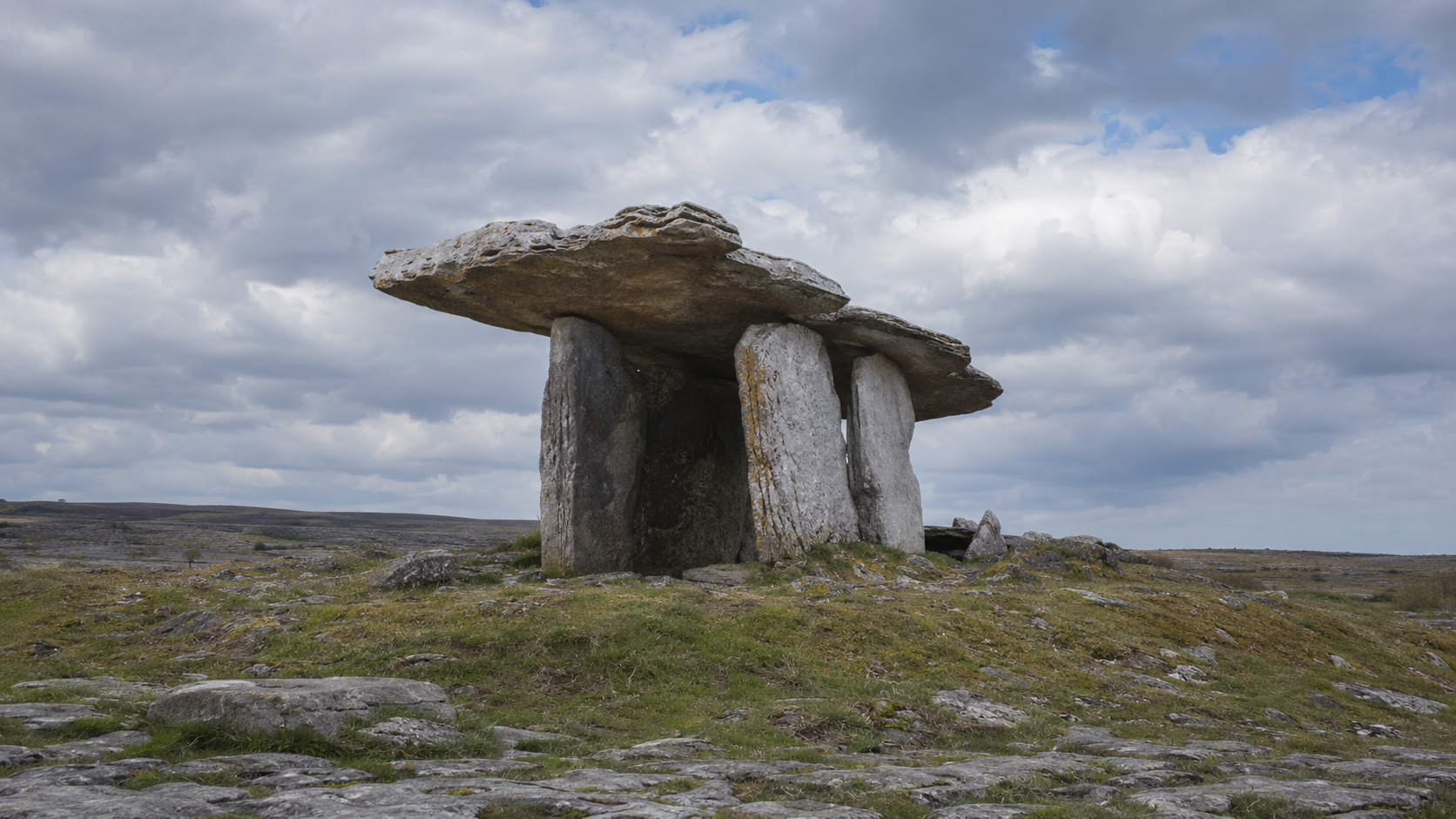
Poulnabrone Dolmen is one of Ireland’s best-known prehistoric monuments, standing prominently upon the exposed limestone pavement of the Burren in County Clare. Its enormous sloping capstone rests on tall upright stones, forming a portal tomb built by Neolithic communities more than 5,000 years ago. Framed by the Burren’s stark karst landscape, the dolmen offers a powerful reminder of the people who lived, farmed and honoured their dead in this region long before written history began.
-
Poulnabrone Dolmen was constructed during the Neolithic period and used as a burial place between approximately 3800 and 3200 BC. It is a portal tomb, built with two tall entrance stones supporting a large limestone capstone. The structure visible today was once surrounded by a low cairn of loose stones, creating a more substantial monument than its surviving stone framework suggests.
Archaeological excavations conducted during the 1980s uncovered the remains of approximately 33 people, including adults and children. Their remains appear to have been placed in the tomb over several centuries rather than during a single burial ceremony. Objects discovered with them included pottery, a polished stone axe, arrowheads, beads, bone ornaments and quartz crystals, suggesting that burial at Poulnabrone carried considerable social or spiritual importance.
The tomb’s prominent position may also have allowed it to serve as a territorial marker, identifying land belonging to a particular community. Evidence of a later infant burial shows that the monument retained significance into the Bronze Age, long after its original period of use. Poulnabrone is now a protected National Monument and one of Ireland’s most recognisable surviving links to the Neolithic world.
-
In The Atlantis Enigma, Poulnabrone Dolmen forms part of the ancient pattern connecting the Burren with the Aran Islands and the mystery beneath the Atlantic. Its location within the Burren’s limestone landscape supports the group’s growing belief that Ireland’s prehistoric monuments were positioned with a purpose extending beyond burial or ceremony.
As George, Áine, Jazz and Irene investigate the connections among ancient sites, underground chambers and ley lines, Poulnabrone becomes another piece of the network associated with the Order of Eòlas. In the novel, the dolmen represents the possibility that Ireland’s earliest communities possessed knowledge later generations misunderstood, knowledge that may ultimately lead back to Atlantis.
REAL PLACES. ANCIENT QUESTIONS
THE BEGINNING OF THE ADVENTURE